Thursday, October 27, 2011

WHERE THE BUFFALO (BISON) ROAM, AND OTHER CREATURES

Bison Herd Custer State Park
Surprisingly our Moroccan Reunion Tour had long segments of bus-riding with intermittent stops at tourism centers, designated overlooks or pull-over spots. This was OK with me, as getting on and off the bus with my short legs and short breath was the hardest effort of the day on me.
Bison - Custer State Park
Thus were the the tours through Wind Cave National Park, Custer State Park, Spearfish Canyon and the Badlands. For me these were good touring days and I still have some good but not excellent photos, most of which were taken while the bus was moving, or through bus windows. This post will be  Wind Cave National Park and Custer State Park. Spearfish Canyon and the Badlands may be one or two other posts. I also have Deadwood and Wall SD, too, as well as two nights dining.


I like to provide historical backgrounds; Four different histories would be a lot to digest in one post.
Bison - Custer State Park
The tour through Wind Cave National Park and Custer State Park was a bus ride with few stops. It was designed to see the natural wild life of South Dakota. The two drives connect with each other.
Wind Cave National Park does have a cave; in fact it is the 4th largest in the world with 135 miles of passageways. However, this tour was not the cavern, but a warm afternoon drive to hopefully see the abundant wildlife in both parks, like bison, elk, deer, antelope, ferrets, prairie dogs and coyotes. During this drive the sightings of wildlife were sparse; it was a very warm afternoon.
Burro - Custer State Park
SOOC (Straight Out Of Camera)

There are campgrounds, a visitor's center, bike trails, and Ranger discovery programs of 2-hour prairie hikes. A Junior ranger program is provided for ages 6-12, as well as evening programs at Elk Mountain campground on subjects like history, geology, wildlife and the prairie ecosystem during the summer.
The CCC (Civilian Conservation Corps), one of Pres. Franklin Roosevelt's more successful "alphabet" efforts to provide work during the Great Depression, contributed to the creation of these parks. The laborers planted trees, paved roads, constructed parks,etc.
Since the roads we took for Wind Cave National Park and Custer State Park connected to each other I will not be able to tell you exactly where the bison/buffalo were taken. We sighted a variety of deer, but not near enough to get pictures through a bus window.

So about all I have are a few bison and the burros; the burros are  not native to the park but added entertainment as they love to snitch treats, especially carrots from tourists and occasionally nip you, if you are not watching. We were not otherwise allowed off the bus, as the wildlife, especially bison are dangerous and temperamental.

All I had heard was prairie rattlesnakes, and so I stayed within the confines of the rules laid down for our safety.

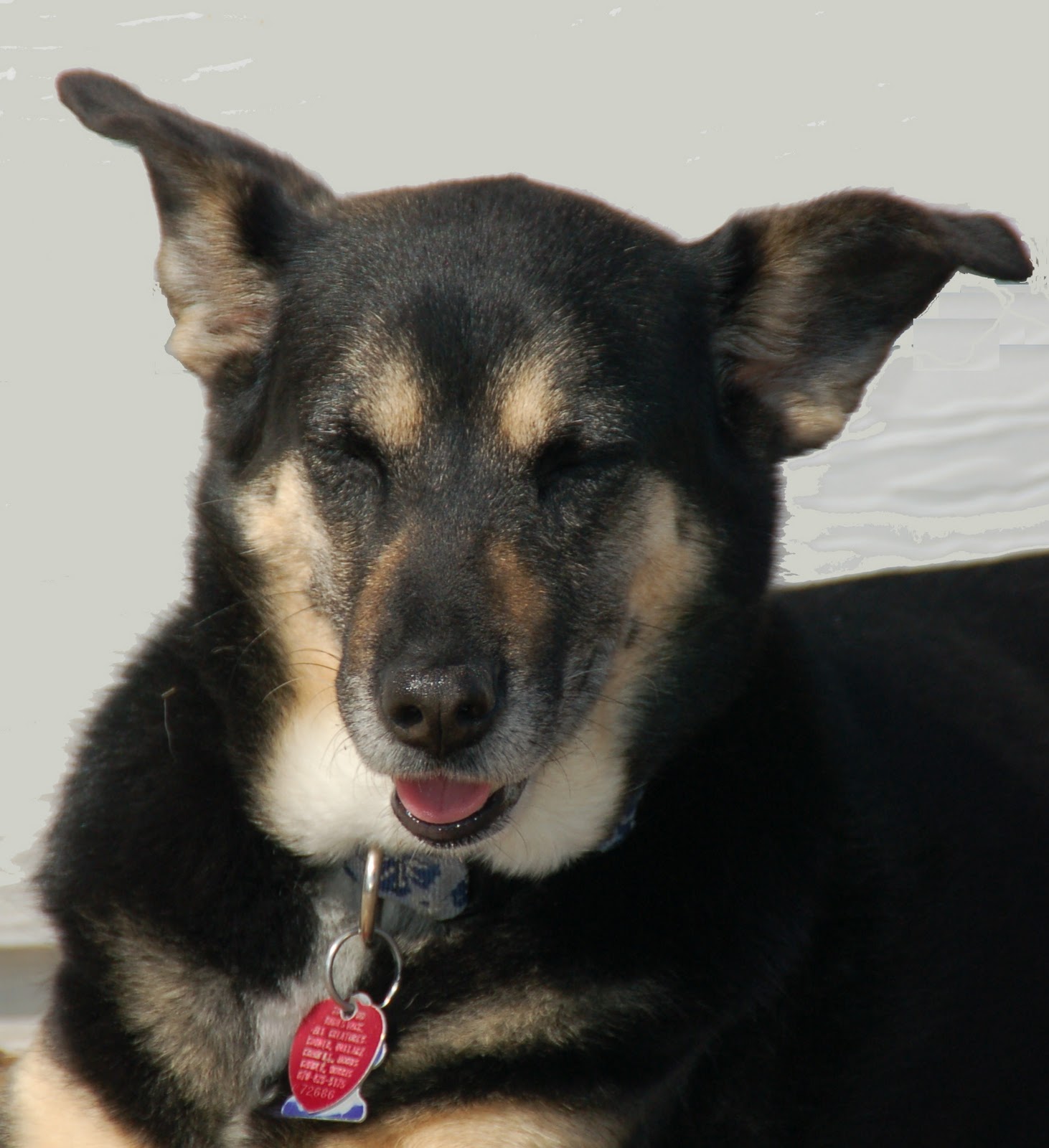
Bison is the correct word for the species that roam America's prairies. Because they resembled African and Asian buffalo, early explorers  (and myself) called them buffalo and the misnomer became interchangeable with bison. Bison have a large shoulder hump.
Burro Begging For Treats From Tour Member
Custer State Park
In Custer State Park, the 2nd largest state park in the U.S., there are 1300 free-roaming North American bison. These bison were/are used in many movies.

Once a year there is an annual roundup, a great event that draws many tourists. The bison are tested, vaccinated, branded and some sorted out to sell at the annual auction. There is a video clip of the roundup at the link given for Custer State Park.
Baby Burro -  Custer State Park
I Thought Look Lethargic And Ill
The wildlife in both parks are relatively the same, but we saw more this particular drive in Custer State Park, which also had some impressive lodges providing a variety of accommodations and full service dining. There are campsites, camping cabins and several scenic roadways. I think the one we were using was The Wildlife Loop Road.

The amenities of both Parks are similar: hiking trails, climbing, bicycling, camping, campgrounds. The Custer State Park was nearer the town of Custer, which offers shops and other local color for tourism.

A tour director tries to choose a variety of sites, so the majority of the tour members will be pleased. However, controlling where wildlife will be at any given time of the day, is not easily determined.
Mama Burro Trying To Entice Baby With Carrot
To No Avail - Custer State Park

Other Burros Not Interested In Treats
Custer State Park

PHOTOS: Photography all by NitWIT

Please watch video at link for Custer State Park as well as read history. I wish we had not been so tired, because we were in still in Rapid City the day of the Buffalo Roundup.
The amenities of both Parks are similar: hiking trails, climbing, bicycling, camping, campgrounds. The Custer State Park was nearer the town of Custer, which offers shops and other local color for tourism.

A tour director tries to choose a variety of sites, so the majority of the tour members will be pleased. However, controlling where wildlife will be at any given time of the day, is not easily determined.

Saturday, October 22, 2011

MAMMOTH SITE - A GLIMPSE BACK 26,000 YEARS AGO

Columbian Mammoth
Have you ever stood by a giraffe, elephant  or even a multi-story building and realize how small human beings are in reality. Suddenly our egos exit. We realize our intellect is all that keeps  us at the top of the heap of living creatures that now exist, and/or once existed on our planet.

This realization came to me as I stood before several Ice Age animals at the Mammoth Site near Hot Springs, South Dakota. I would loved to have had more time at this location. But as I have said before, group tours are scheduled and you move when told as there usually is another group tour arriving behind you. If you have not already read the link provided, it is well worth your time.
Husband & I In Front of Same Mammoth In Picture
Above [Picture Taken For Feature in Area
 Newspaper Called"Where In The World
Is the Baxter Bulletin?"
Paleontology is simply define as the study of prehistoric life, but it has many subtypes, not just bones and fossils. Superficially, one would think this site is just that, until you see and read about its discovery and history.
Giant Short-Faced Bear Skeleton

The Giant Short-Faced Bear Plaque
The Mammoth Site is the world's largest research facility which claims to have discovered about 58 Columbian and woolly mammoths, as well as other prehistoric animals like bears and hippopotamus.There are other mammoth sites in U.S. at Waco, Texas and other sites in Arizona, Colorado, New Mexico, Nevada, Texas, South Carolina, Utah  and Virginia,Wisconsin and Washington, as well as several in Kenosha County, Illinois. I may have missed several other sites.
Some of these sites are more the prehistoric human, predecessors of an earlier generation of Native American than those occupying the land when America was settled.
The Mammoth site in South Dakota through a series of climate changes became what is known as a karst sinkhole, which was a steep hole, a watering hole or pond for thirsty animals. The huge mammoths would enter the water to quench their thirst, eat or bathe. But their bulk and weight prevented them from getting a foothold to climb out the steep banks. The animal would become exhausted from their many attempts and falling, until fatigue conquered and the animal drown.


The sinkhole became a mass grave for mammoths and other prehistoric beasts. and finally filling the karst with a wealth of prehistoric bones fauna and other natural wealth, well entombed and protected by silt and mud.
<>                                          
Almost Complete Skeleton Imbedded Mammoth Site In Karst Sink Hole
Upon discovery the edge of the karst sinkhole was determined and housing was built over it to prevent erosion. It is a remarkable sight to see. The discovery was by chance when heavy equipment was excavating for a housing development, but instead found South Dakota's greatest fossil treasure.
Partially Exposed Skeleton in Mammoth Site Karst Sink Hole
The Mammoth Site is not a part of the National Park System but a non-profit 501(c)(3) organization. Besides the indoor fossil bone bed, there is a working paleontology laboratory, Ice Age exhibit, ongoing research and education, and a Junior Paleontologist Program (June 1- August 15). There are teaching materials, "Mammoth in a Trunk" teaching kits with teacher support materials, video teleconferencing, and Boy and Girl Scout Merit Badge classes.
Embedded Tusk - Mammoth Site Karst Sink Hole
The Site has co-hosted international conferences and publishes scientific Quarternary research materials. "Quarternary" refers to the Ice Age prehistoric natural history; in this case, emphasis is on the late Pleistocene age.

Mammoth Site has received many accolades, including 2009 Distinctive Destination by National Trust of Historic Preservation, AAA "Gem Attraction" and the Great American Road Trip-Black Hills-South Dakota.
Overview Of About 50% of the Mammoth Site Work Area
There was much more than I could absorb in the hour and 15 minutes allotted our tour. We followed a bus tour and another followed us. So we had to keep moving...to a nearby restaurant named "Woolly's" in Hot Springs, SD, which was a sandwich bar with salads, dessert and non-alcoholic drinks. [could not find an Internet link that exactly matched the restaurant.]


Enjoy the photos. Click and enlarge to see details you may not see in blog size.
This tour and Crazy Horse Museum I wished for much more time, but am blessed I was granted health and relative stability to make the trip and essentially complete the tour as well as the road trip to and from Rapid City South Dakota.


Below are two YouTube videos of Mammoth site in Hot Springs, South Dakota and Waco, TX.


YouTube - Mammoth Site SD

You Tube - Waco TX

Photos (except YouTube) made by NitWit1

[I encountered some problems with formatting; don't know if it is me or Blogger. Since I have had two different composing Windows for whatever reason since In returned home, I tend to think it is Blogger. It is always interesting to see what Blogger will throw at me next.]

Wednesday, October 19, 2011

MOUNT RUSHMORE: REPRISE


Classic photo of Mount Rushmore
Photo From Mount Rushmore Brochure
Showing Sculpting In Process - (Appears
To Be Thomas Jefferson)
I know I released a photo of Mount Rushmore Sept. 23, but this is a more detailed post, the highlight of our bus tour. You can find hundreds of hits on the Internet. Its inception was by South Dakota's state historian Doane Robinson, who, in 1923, suggested giant statues be carved in the Black Hills to draw tourists.
Husband at Mt. Rushmore
As with all big ideas there were scoffers to downright hostility to a new, different ideology. There are outcroppings of tall, thin peaks, called the Needles,  which resist erosion in the Black Hills. Robinson's imagination was the Needles were a parade of Indian leaders and American explorers, shaping the American Frontier. [I saw some of the Needles, but failed to get a photo. Some Needles' shapes reminded me of stone thin evergreen trees.] Here is a link to a YouTube film clip of scaling and climbing the Needles

You would not find me trying to scale the Needles; I cannot scale a Porta-Pot without falling--maybe the key for me is some equipment!!!

An unconventional sculptor, Gutzon Borglum, sculpting in the shadow of  brother, Solon, was making  a name for himself  at Stone Mountain Memorial in Georgia.  He was patriotic, beginning to create a reputation by sculpting 'the celebration of things American' which meant BIG. 
NitWit1 at Mt. Rushmore; the Rollator
Was Great To Help Me In Walking,
Carrying Camera, Oxygen, Emergency
 Medicines And Warm Apparel.
This Was the Highest Altitude Of
The Trip. I Had Lots of SOB, But
Recovered Quickly With Several
Whiffs of Pure Oxygen.
[Photo by Husband]


After determining the granite of the Needles did not meet Borglum's criteria for large sculptures, he began scouting other locations for another solid durable granite mountain. He chose Mount Rushmore named in 1885 for New York attorney Charles E. Rushmore. His criteria included the exposed granite face southeast to receive sunlight most of the day.

Borglum envisioned four Presidents in commemoration of the foundation, preservation and continental expansion of his beloved country. 

He chose George Washington [head dedicated in 1930] as liberator and First President to anchor the left position. Washington deeply believed in liberty and the Republican model of government entrusted to the American people.  (paraphrased from his First Inaugural Address].

Gutzon Borglum
[One Place I Should Have
Used Polarizer To Reduce
Reflections Shown On Plaque]
Beside Washington is Thomas Jefferson [head dedicated in 1936], chosen for his influence and writing of the Declaration of Independence, his two terms as President and mastermind of the Louisiana Purchase.

Mount Rushmore
and Avenue of  Flags

Sandwiched between Jefferson and Lincoln is Theodore Roosevelt with mustache-somewhat thicker than I remember [head dedicated in 1939] who promoted progressive causes like conservation and economic reform,  and expanded the country's influence by promoting the construction of the Panama canal.

T. Roosevelt had a sickly childhood, suffering severe asthma. As was his mantra, he took the"bull by the horns" and converted his image to an outdoorsman, who once owned cattle ranches in the Dakotas.
Mount Rushmore - Avenue of Flags
Long View

Anchoring the far right position is Abraham Lincoln with beard, albeit shorter than I remember [head dedicated in 1937], whose leadership restored the Union and ended slavery.

Dedication apparently did not mean the sculpture was completed. It appears it meant a commission was let to begin the sculpting.

The memorial was completed in 1939.  However the memorial site was dedicated by Calvin Coolidge in 1927. Actual carving took only 6 years, but it took 14 years to completion as funding had to be found. Borglum lobbied from state to federal officials in a manner he called a "one man war" to fund his work as a national memorial. Finally $836,000 of federal money brought the final cost to nearly one million, a tidy sum in 1930s, but not today.


Another Classic View of Mount Rushmore
Borglum died  in 1941 before completion of the memorial, but son, Lincoln Borglum supervised completion. Although Gutzon Borglum had dreams of an entablature engraved with a brief history of the country and a Hall of Records to preserve national documents and artifacts, work stopped in  October 1941; the time was nearing for his beloved America to defend the very principles his memorial exemplified and preserved in the granite of South Dakota.

Final dedication was held in 1951. I do not remember this but I was a teenager in that time period, probably not pursuing history.

We missed the evening lighting ceremony as it is conducted in an amphitheater nearer the monument. There was no way I could navigate the steps of the theater. I understand it is inspiring. But I am thankful for having seen one American National Memorial I admired. There is a Presidential walking trail to an area near the base of the monument, a Sculptor's Studio, visitor's center, visitor's services, Lincoln  Borglum Museum, gift shop. book shop, audio tour building, and restaurant. We took in the visitor's center.
Mount Rushmore and Avenue of Flags
Note: Arkanas Flag - Up-Front on Left!
Statistics of George Washington's head:
Tall as a 6-story building.
Nose length - 20 feet (I guess we can call him Pres. Long-Nose, Indians might use such nomenclature.)
Mouth - 18 feet, again Mr. Big Mouth.
Forehead to Chin - 60 feet.

Question 1: Have you figured out what's missing on all 4 Presidents? What else may be missing from one President? [it is hard to tell from photos]

The Avenue of Flags was added in 1976 for the U. S. Bicentennial celebration. Was I every surprised to see Arkansas's flag, front and center on the first of the two multi-sided column rows of flags. Above link is incorrect in that at least Arkansas was on the 'Washington' side. However I believe the placement, which is alphabetical, started with the columns near the monument--not sure, but seems the only way Arkansas flag would have the position it had from position I took the photos.

All my photos plainly show the Arkansas Flag.

These Two Huge Rock Formations Reminded Me Of Two
Comical Old Men Watching over Mount Rushmore! This
photo was taken looking across street of entrance
to Mount Rushmore.
QUESTION 2: There 56 flags for each state, district, commonwealth and territory. If 51 account for 50 states and district of Columbia, what are the others? 

Question 3: If a similar sculpture were created today, what Presidents do you think might be chosen today?
Mount Rushmore and Avenue of Flags
Arkansas Flag Prevalent in this Photo
(my favorite of this shot)
Construction of Mount Rushmore
Photo of Government Provided Brochure
You May Be Able to Enlarge and Read
The Print on the Right of Photo
PHOTOS: by Nitwit1, unless otherwise noted. 

Some phrases and information attributed to Mount Rushmore National Memorial South Dakota (brochure), provided by National Park Service, U.S. Department of Interior, GPO 2010-357-940/80401 Reprint 2010, printed on recycled paper. I found no copyright; our taxpayers footed the bill, so I don't think I am in violation of any law, especially with this attribution.

Answers to questions 1 & 2


1. Missing on Presidents: (a) EARS; (b) Theodore Roosevelt wore Pince-Nez eyeglasses in nearly all photos I've seen. However, Sculptor Gurzon Borglum knew him personally.


2. Flags (not 50 states or District of Columbia): Common Wealth of Puerto Rico, Territory of Virgin Islands, Territory of Guam, Territory of American Samoa, Commonwealth of Mariana Islands.


3. Opinion - mine only:

George Washington, Thomas Jefferson, Abraham Lincoln, Theodore Roosevelt [for reasons already stated] would probably make the list.


Add Franklin Roosevelt - held the union together through Great Depression, WWII


Ronald Reagan - led the union through stagnation of economy, ended the Cold War


Possibly John F. Kennedy - equalization of races continued by LBJ after JFK's asassination,  but certain decisions began to stir Vietnam conflict. My brother was a Navy radioman privy to top clearance; after discharge he declared JFK was responsible for starting war in Vietnam. His response to certain foreign affairs initiated certain events leading to conflicts.

I considered Dwight Eisenhower as the Interstate Highway System  began under his watch and provided many jobs, but his WWII service seemed to overshadow his presidency which was considered mediocre by some historians.

History is not complete on Bill Clinton or Barrack Obama for me to make a decision; I lingered on Lyndon Johnson as he created Medicare/Medicaid, but he escalated the Vietnam War, IN MY OPINION.

However, sculpting a  memorial of even 4 presidents, much less adding 2 or more would never happen in our current political environment and economic instability. I can hear the yowls if Congress was asked for such funds with a 14+ trillion dollar debt to service and pay, looking them in the face. 

Another link with interesting information is here.

I reallly recommend a visit here and plan to spend a day to take advantage of the amenities offered. A large number of hotel/motels are located near the memorial. It is a national park so senior citizen passes are recognized.

Saturday, October 15, 2011

WHERE IS DON QUIXOTE?

Wind Turbine I-90 (Husband photo)
When traveling home across lower Minnesota and upper Iowa, I was reminded of Don Quixote, man of La Mancha, who among other feats battled windmills in the two volume classic written by Miguel de Cervantes. Cervante's two volume The Ingenius Gentleman Don Quixote of La Mancha is considered a founding work of Western literature and often appears on many list of best literary works and basis for musicals and other works of art, including Picasso.

So what triggered my memory of Quixote?

Windmills of course, except they were wind turbines, allegedly to be the modern salvation of energy for electricity, or at least subsidize present sources of electrical power. Texan T Boone Pickens, an oil millionaire, but surprisingly an environmentalist, is a proponent of wind turbines, natural gas as major substitute for many crude oil uses, a grid of electric recharging stations for electric cars and preserving/distributing clean water.
Wind Turbine Field I-90

Wind turbines were on hills and open land along wide spans of I-90 and into upper Iowa along I-35. Husband [H] and I had never seen so many wind turbines located along a single span of highway. Texas has wind turbine farms, especially in West Texas, I have heard. [See another wind turbine at end of this post with a question.]
Iowa Roadside Park (Husband Photo)


Along I-90 in lower Minnesota, at a very nice rest stop, H discovered this plaque about the connection of I-90. A large plaque marks the area and gives a history of completion of this important east-west interstate highway. [See
photo at end of this post.] 
Iowa Roadside Park (Husband Photo)
If you thought you had heard the last of the porta-pot, husband (H) needed rest stop in Iowa somewhere south of Des Moines, I think. The condition of the ROADSIDE PARK  sign at the designated area should have said "keep on truckin" but we stopped.

There was an ancient red house, with every entryway boarded and, yes, an ancient porta-pot in the back yard. I learned my lesson to avoid porta-pots earlier in the trip. H did not use the porta-pot, and obviously the house was not accessible.
Iowa Roadside Park (Husband Photo)

Truthfully, I think Roadside Park and (Roadside) Rest Stop are different genre along highways and byways. Roadside parks usually have picnic tables but not necessarily other facilities. Oklahoma has lots of roadside parks and their signs add 'no facilities.' Rest Stops have facilities, usually outdoor tables, and sometimes places to walk dogs for doggie relief.
Iowa Roadside Park Porta-Pot -Wonder How
Many Snakes Abide Inside/ Outside Here?
We discovered a new food restaurant chain on the return route called Perkins Restaurant and Bakery. The food is reasonably priced; generally two can eat for about $20. The tip may run it over a bit.

It seemed to originate in Iowa and prevalent in the Midwest. There are several in Missouri and one in  Blytheville, AR. See their site for locations. 

Their specialty is an all-in-one dish served in a huge biscuit shell. I did not try that-too many calories. I consider it a personal triumph to have only gained 2 pounds on this near 3-week tour. 

Our arrival in Springfield and then home went as planned. We arrived home prayerfully thankful for a trip filled with memories for the rest of our lives and gratefully to be all in one piece.

H drove every mile and his back suffered some discomfort. My heart-asthma-COPD acted up, but I was prepared with medications to subdue them, nor did either of us miss but one scheduled event.
Luckie Dozing  On Our Covered Deck

Luckie, for once did not pout after her long stay, but she is still a bit apprehensive when we both leave, either together or separately. This is somewhat normal for her as she has anxiety syndrome when left alone. The syndrome is much better than her rather destructive behavior when she was younger.

Posts still to come: Mount Rushmore, Crazy Horse Monument, Mammoth Site, Custer Park, Spearfish Canyon, Badlands.

How many forms of energy being generated, consumed or possibly becoming a source of energy or recycled energy,can you find in the above photo. My list below next photo. You may find more!

Plaque At Rest Stop And Junction Where East-Bound
and West-Bound I-90 Were Joined. Very Interesting!

My answers.
1. Wind turbine garners wind energy.
2. Power lines carry energy to designation end user.
3. Trucks [left lane] using diesel or other form of petroleum, and various petroleum lubricants, which can be recycled.
4. White line on horizon may be jet contrails; hence aeronautic petroleum use.
5. Car [right lane] very edge of photo, petroleum or hybrid today; hydrogen, electric or natural gas in the future.
6. There is a crop which appears to be corn in the field which possibly is used to make alcohol to be mixed with petroleum products for vehicle consumption, or, depending on purity, might be used in other commercial products.
7. In the very far distance I believe there is a clump of trees. Regardless, trees, weeds, grasses all could be used to provide heat by burning.
8. The sun was shining this day and photo was early morning. Solar energy can be converted to several kinds of energy.
9. I wonder if atmospheric carbon dioxide, which is supposedly causing the 'green' effect, can be converted to something positive? [Maybe we should be looking at that instead of scaring bejebees out of  us!

Wednesday, October 12, 2011

CORN PALACES, RINGS AND TIN POSTCARDS

Days Inn Range Country, Murdu, SD
As we packed to make the long journey home we were not quite through with our sight- seeing and souvenirs.
 
My husband (H) wanted to revisit the motel we stayed in Mardu for some tin mailable postcards he had seen. This Best Western had an unusual lobby and common area with numerous mounted animals lining the ledge of below a high ceiling and small windows for natural light.
Sign  at Days Inn Murdu, SD
 I will scatter some photos throughout this post. The motel was independently owned as most  in the chain are. The manager was very pleasant and helpful.

The original owner was a hunter extraordinaire and the motel appeared have been a hunting lodge at one time. I am not a hunter nor have a hunter's mentality for trophies. We generally put fish back for someone else's enjoyment. It is consider the best policy rather than killing them and then they are discarded due to freezer burn.
The Hunter
If trophies annoy you, scroll down to the Corn Palace photos.

A tip from my best friend's mother, I should visit the Corn Palace in Mitchell, SD, so it made our stop agenda for the first day's journey home.

Both places were on I-90 before Sioux Falls SD, our first destination night on the return trip home. Because of closings along I-29 due to Missouri River flooding, we could not depend on being able to deal with too many detours. As fate would have it, the morning we set out for home all of I-29 was opened.

Open attic display of South Dakota game
After rechecking the room for items we may have overlooked in repacking, I made one last attempt to eliminate morning decaf coffee,washed my hands and exited our 10-day room-away-from-home.
South Dakota Flying  Game
Somewhere before Mardu along I-90, I needed another pitstop, so we pulled over to an unmanned rest stop, with a entrance sign: "Beware of rattlesnakes!" I carefully stayed on concrete walks, checked out toilet area and sinks before I used the handicapped stall.  It was a very short stop.
More South Dakota Game
We entered Mardu and H got his tin postcards[ sort of neat] of Mt. Rushmore, and some regular cards of buffalo. The manager recognized us and pleasantly inquired about our trip.

Then we were back on the Interstate headed for Mitchell and the Corn Palace. [ please read link as I cannot regale all the interesting features.]

Just as we approached the exit for Mitchell, the second near-disaster struck. I notice I was missing my engagement/wedding rings. I hesitated to wear them on this trip. I had not worn them for years, until last year I had them stretched to fit my ring finger which had an arthritic knuckle as well additional flesh--translate fat.

Left: my missing engagement/wedding rings;
Right:Husband's ring which does not fit and he left home
Of course, I panicked. My handwashing ritual is to take the rings off as soap residue creates a rash on my skin. I figured I left them at the rest stop. As it was unmanned, we could 'color them gone.'
We passed the Dept of S.D. Transportation as we entered Mitchell. I asked H to stop and let me talk to them. If a patrolman was in that area, he might miraculously retrieve them.


A patrolman just happened to pull in. We told him our problem and he called two units to check two rest stops as we were not sure the exact location where we stopped. There were two possibilities. Suddenly we were not hungry, not too interested in the Corn Palace, either. Fortuitively, we did, as you will see in a bit my memory had a critical but accurate moment.

Ear of Corn Welcoming Statue
From childhood my life is littered with my left-behinds. My mother was frustrated with the numbers of sweaters and head scarves I lost. I've left my purse in more Wal-Mart carts than I can count. I can attest there are many honest people around as I have always retrieved it. At home my husband deals with misplaced glasses (now readers or sunshades) or car keys. I don't think this is hereditary, but is a lack of attention, I suppose, maybe adult attention deficit???

However, something led us to continue to the Corn Palace which was interesting. The exterior is covered with huge murals made of corn. I did not know there were so many colors of corn. In fact another building is being built next to the Corn Palace and seemingly connected to it. Somehow, I was under the misconception the entire building was corn.
The murals are kept in exceedingly beautiful condition and new designs regularly approved by a mural committee.
Light pole with flowers and
corn isignia a base
The building is multi-purpose with many events occurring here.

There were other interesting  tourist attractions across the street, some related to the Corn Palace. Somewhat SOB (short of breath) I sat on a bench to regain my mental and physical composure. I mulled over the rest stop and did I have my rings at that point? Or had I washed my hands before this point? YES! before we left our motel room. Hope reigns eternal. My spirits lifted.

When we returned to the pickup I used our cell to call the Best Western Ramkota Hotel in Rapid City. When the phone answered, I told them who I was. Before I could ask a question, in an unusual happy tone, the receptionist said, "we've been expecting your call."

Indeed when I asked if a set of wedding rings had been left in our room, it had, and our maid whom we had left a nice tip, immediately turned them in. They were returned COD so as to know we received them. The rings were with all our mail held at the post office for pickup on our arrival home.

Front: Corn Palace (Husband's photo)
We relaxed after knowing the rings were probably safely on their way home and we proceded to Sioux Falls, SD for a night's rest!

PS: I had nurse practioner check the knot near a bruise from my porta-potty fall. It is a hematoma, but near surface and not the dangerous kind that is like to move around the body to lungs, heart or brain. She said those kind are usually located in the area behind the knees.
Right Front Mural

Left Front Mural

Middle Front Panel
(May be my or my husband's photo)
Be sure to read Corn Palace link and see other murals. All sides of the building has murals made of corn! It was too hot to walk around it with my shortness of breath and the fact I was distraught over my missing wedding rings.

Photos: all by NitWit1, except as noted.